
We have help leaving Gorge Harbour. We say our goodbyes, go through our pre-cruise routine, say our goodbyes, queue at the fuel dock, say our goodbyes, and it is noon already when we actually leave the marina.
Also heading out is Zuma ahead of us, and Chiquita behind us waiting to fuel up.

Jake is allowed to ride in the cockpit for a time while we are at low speed. He loves looking out at the water and having the wind blow past his ears.
It reminds me of a hound-dawg riding in the back of a pickup truck.

We choose a speed of 6.5 - 7 knots on the calm seas, and sit back to enjoy the scenery.


It is nice to see the fuel economy at three times what it was with the previous days' speeds.
We go south around Sutil Point at the end of Cortes Island, and then turn northeast toward Desolation Sound.
At this low speed and with the window open, we hear the bell at the point sounding its alarm of the rocks.


Chiquita catches up with us and rounds the bell.
It is such beautiful scenery with the snow capped mountains and rocks lining the shore.


Breaking the spell is a boat overtaking us on the port side -- oh, it is a Cutwater!
It is Port Boathouse on the adventure for the day.


The trip so far is pretty quiet until we get some big wakes and hear on Channel 16 "You in the go-fast boat! Slow down."
We see a familiar boat -- a green Ranger Tug -- who is overtaking us on the starboard. Is it Chameleon?

We cannot see any identification, but she is flying the Canadian flag. Looking good!
We have much cross traffic near the entrance to Desolation Sound, and many vessels overtake us. They must be in search of the good places to anchor for the evening.

We pass what we think is a kayak with a small passenger, but as we near it, we see it is a very long log with a large root.

As we enter the area of Desolation Sound, I am so excited! I have finally arrived at the much talked about vacation spot.


This is part of what it is all about. The beauty of the mountains, the sea, and the clouds. Another thing is the temperature of the water.
Warm. They say.
We go north of Mink Island and into Homfray Channel.
Somewhere along the trip today Herb decides to check out Laura Cove.
But, oh, my! It is very crowded. Moving slowly along in the cove, we search for a safe place to anchor. We are aware that there are many rocks in the cove. We see the perfect spot for us beside a beautiful wooden boat.
As we approach, its skipper comes out to be of help and points us to come beside him and away from some rocks that come and go with the tide.
He is Jim, and with the help of his wife, Heather, they raft us briefly while we position for anchoring.
They are on holiday with granddaughters, Ella and Amelia, and darling dog Brandy, traveling aboard Pacific Loon.
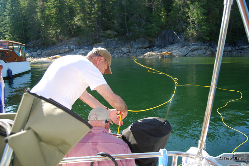
Jim, the girls and Brandy jump into their dinghy to tie off our stern 'anchor' line. Rowing to shore, the girls climb the rocks with the line, loop it around a tree and bring back to us.


The girls have apparently done this many times, and seem to enjoy it.
Herb plays out the line.

Ella finds the right tree.


And brings the line around.
Brandy helps.

Jim and Herb secure the ends to the swim platform.
Now we are home for the night, with great neighbors!
Jake gets his afternoon ride to shore for his exercise.


All who are anchored are along the shore.


There are quite a few teenagers here today and they enjoy the rope swing.
I'm told the temperature of the water is 70 degrees -- warm!
When I look surprised, they say that this is as good as it gets, for ocean swimming.

(When we left Anacortes, the water temp was around 50 degrees.)
Yes, this is warm.
As we dinghy around to see what we can see, we explore the inlet that leads to Prideaux Haven and then into Melanie Cove. We are told there are clams to dig in the area between.

As we row past, we also see the rocks that are beginning to be covered by the rising tide.


Find Willie's Tug. It could be the yellow one on the right. The Ranger Tug.
For a point of reference, we note the raft of boats across the rock wall from us. The wall has almost disappeared and we can see the nearest boat quite well.

And here is the same area at the lowest tide so far today. Rock wall is visible and masts of rafted boats is all that can be seen now.
Tides vary here between 7 - 10 feet.

 |
| Pacific Loon |
Willie of Willie's Tug,
and Walldog, Willie and Jake
Such beautiful photos...and a wonderful story to go with them!
ReplyDeleteWillie...fyi...this is Barbara...your "anonymous" poster...
ReplyDeleteThanks! It was fun!
ReplyDeleteTwo big thumbs up for your travelogue!
ReplyDeleteJim & Joan
Hey, thanks! Means a lot, coming from the two of you!
ReplyDelete