Sunday, June 28, 2015

The Eagles Show - to Codville Lagoon -- 6/21/2015

We wake in Fury Cove across Fitz Hugh Sound from Calvert Island to see not a leaf moving, no wind at all, and the boats appear to be sitting on glass.  Everything is still and so peaceful.   The sun is shining brightly and the temp is already up to 64 degrees F. 

With only 40 miles to go to Codville Lagoon, we have a leisurely morning and weigh anchor at 9:58A.  Fog drifts in, and as we make the turn into the Sound, I cannot see Calvert Island, but visibility is quite OK for safe travel.

Ocean swells greet us and soon we see the BC Ferry, Northern Expedition, who probably sent some waves our way.  The fog thins as we travel on northward and visibility is perfect.  
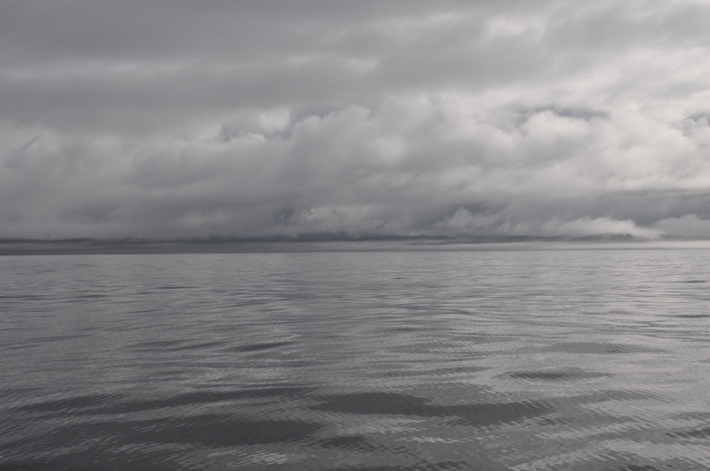
Cerulean blue is overhead with spotty dark clouds and a few whitish mares’ tails.  Fog hangs near the earth, suspended in mid air.


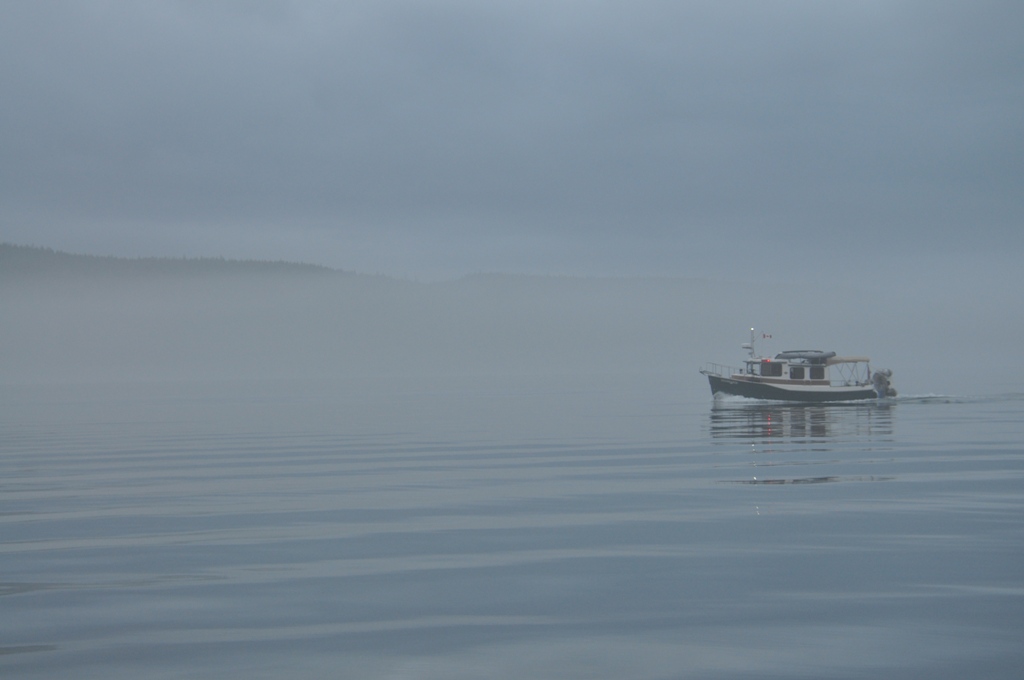
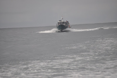
Performing our constant lookout, we note something white ahead of us in the distance, and getting bigger.  Or should I say, “Appears larger to the eye now as we approach.”  (Laughter is heard in the cabin.)   So we know the vessel is coming our way or we are overtaking it.  The swells are gentle with 1-2 ft. chop, becoming flat calm near the entrance to Koeye channel because we are more protected by Calvert Island.

About three miles south of Koeye River Inlet I spy an eagle on the starboard shore and hurry to the cockpit for a photo.  Herb slows Willie’s Tug for me to take advantage of the show as another eagle joins the first, then one flies.  Was he chased away, or wanting his own tree?


Friends


King of the Forest

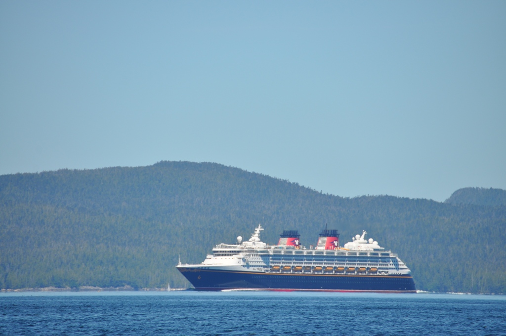
Continuing on we see a few white caps, but the water is definitely not rough.  Ah, another cruise ship comes south – again this one is Disney Wonder, 294 meters long, and the one Kenny was on earlier in the month with his family.  Ray radios us that we should ask him if he went below to fix the shear pin.


We arrive at Codville Lagoon at 2:15P, after which Herb and Ray put out the crab traps.  We anchor in 32 feet, letting out 120 foot of rode.

Nudibranch entering Codville Lagoon

Sonar shows the Lagoon Floor

Willie of Willie's Tug,
   and of Walldog, Willie and Jake
   Sunday, June 21, 2015

We are Cautious at Cape Caution -- 6/20/2015

After a good night’s sleep at Port McNeil, we are up at 3:42A, Herb turns on the coffee maker and heater to warm the cabin against the 50 degree outside temp.  Life is good.  A 5 o’clock start sees the sailboat docked in front of Nudibranch leaving first, then Herb and I hand Ray his lines and follow him out of the harbour of North Island Marina in the misty dawn.


We turn into Broughton Strait which leads west to Queen Charlotte Strait, with Vancouver Island on our port side and Malcolm Island on our starboard.

A 5 knot speed enables us to see a safe distance ahead through the fog, and the white flashing beacon at Graeme Point is a helpful navigation aid.  Once out a ways we increase to 7 knots.

Nudibranch in Fog

Nudibranch passing Graeme Point


 Barge with Fuel Tank, Superior

Kelp Beds - Nuisance


Now Herb sets the speed at 12 knots to make our way past Cape Caution while the winds are at the predicted light until late afternoon.    Here it is worth mentioning that Vancouver Island is narrowing as we approach the northern end – and the Broughton Islands and many finger peninsulas of the mainland of BC are on the starboard.

Our heading is NNW across the Strait toward Cape Caution, which is the western most point of BC and on a parallel with the northern tip of Vancouver Island.
It is cloudy and a fine mist spots the windshield, as I look out at flat calm seas that begin to gently swell.  


The photo of the map shows Queen Charlotte Strait, and we are at this moment by the "L" of Charlotte.


Our estimated time of arrival at Cape Caution is 9:10A, then the roughest water will be behind us. 

With the clouds and rain, the cabin cools off and Herb turns on the heater coming off the engine. 

Even in the fog, I enjoy the different surfaces of water, but hard to get a good photo.


We go east of Deserters Islands group and Echo Island.   


There is a break in the clouds ahead.  Ray sees a whale off his port bow, but we finally see something and can’t tell for sure what it is.  I think I see a bottle nose. 

Whale?  Or seal?


Now we begin to get big ocean swells 2-3 feet  in Queen Charlotte Strait, one and a half hours yet to get to Cape Caution.

We increase speed to 14 knots to smooth out some tops, and I remember the words of Toni about being glad they were past the rough water as they made their trip north last month.  

Herb sees on AIS the cruise ship Celebrity Millennium at 15 knots a few miles astern, and going to Ketchikan.


Egg Island has a white light beacon on our starboard.  Ocean swells are now 2 feet with a lite chop. 


Now Rounding Cape Caution
Nudibranch in the Swells

Construction Barge

Logs, Logs, Logs!


It is bright sunny now through the helm door, with low billowy clouds at the horizon.  Their shapes suggest an upper level wind.  Swells are more gentle now and seas rippled off Cape Calvert at the southern tip of Calvert Island on our port.  We are 30 minutes from our inland destination for day. 
  

There must be good mud or sand in Fury Cove, as anchoring is easy at near noon, and we find a spot on the northwest side at a depth of 25 ft at low tide and 35 at high.  Herb let out 130 feet of rode.    We see two power boats and a sailboat, but there is room for more.  Before long the American Tug leaves, then the other power boat heads for her next adventure.

Sonar of our Anchorage


This is a really neat spot all tucked away from the main stream of channel traffic, and with a vantage view of interesting vessels moving about.  A cruise ship from Alaska heads south, and Herb identifies it as Disney Wonder, the one Kenny took to Sitka recently.


Uh, oh, a little problem with the Torqeedo motor -- it won't start!  Did it get too damp last night?  Or is it some other problem?   Never fear -- With Herb's earlier experience in electronics, he knows something about rheostats, and soon the motor is working again.  He gives me a thumbs up! and will be on his way to check his crab trap.

 Willie of Willie's Tug,
   and of Walldog, Willie and Jake
   Saturday, June 20, 2015

Friday, June 19, 2015

Amazing Day! -- 6/19/2015

It is cold in this little inlet!

53 degrees out and 61 in, the coolest sleeping so far on the trip.  We will start the evening tonight with more bed cover. 

The first sounds of the morning at 5A are the waves softly slapping against the hull.  Peeking out I see we are slowly turning on the hook, and there are small ripples on the surface of the cove’s water. Herb turns on the generator, as we don’t have quite enough battery built from yesterday’s partly cloudy skies to run the electric coffee-maker – plus I am ready to heat the cabin with the diesel heater.  

I see a pink sky above the tall, tall stately evergreen tree forest, and anticipate the warmth the sun will grant us soon.


A few gray clouds scatter across the sky, but promise clearing.  We listen to Environment Canada’s marine forecast on Channel 21 to confirm Johnstone Strait has light winds that will increase to 15 – 20 in the afternoon.    We plan to head that way by 8A and go as far as conditions are good, with a plan to tuck in to Lagoon Cove along the way, if necessary.  Maybe we can make it before the afternoon.

Before we leave Small Inlet anchorage, we cruise over to say Hello to a Ranger Tug we had seen come in late yesterday afternoon.  They are Mike and Ruby of Ruby from Montana and have just returned from Prince Rupert BC.


Wispy clouds float behind the mountains and delight me with their colours.


Following Nudibranch....


We get a call from Ocean Aire I inquiring about our travel plans.  Skipper has enjoyed watching us overtake them.


Our cruise today is littered with logs and logs and trash.  This one is a tree with the roots protruding.


A nasty flotsam greets us. Thankfully, we miss all the debris and are soon at Port McNeil -- well ahead of schedule.


Amazing day -- WX conditions are perfect, and if it weren't for the logs and trash near Port McNeil, we could have put Willie's Tug on auto pilot and taken a nap!

75 nautical miles,

Find Willie's Tug and Nudibranch....

Willie of Willie's Tug,
   and of Walldog, Willie and Jake
   Friday, June 19, 2015