I wake early dawn to see if more boats came in during the night to anchor here in Baker Inlet, and barely can see a sailing vessel with anchor light on. We leave the inlet at 5:40A with clear visibility, but clouds hang over the bay and rest on the
mountain.
 |
| Sailboat Predawn |
Eagles watched over us last night. Ray tells us that last night he took Lilly in the dinghy and saw a mother loon with her chicks nearby. They suddenly huddled together with their heads in the water to make themselves look big to the predators passing by. He also says he saw signs of bears on the beach, so we must have had company last night.

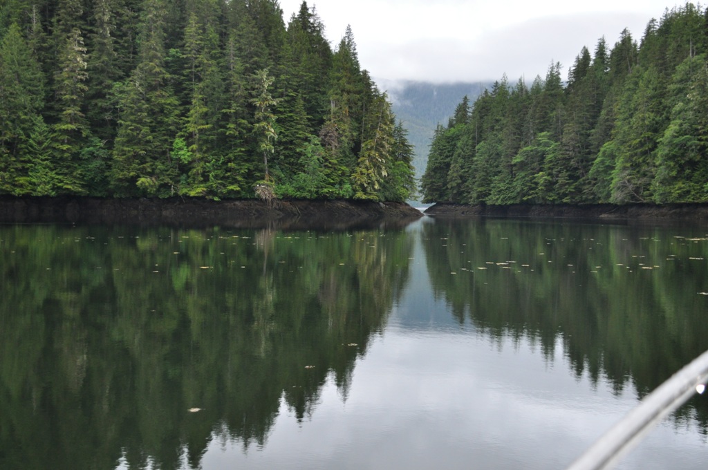
Baker Inlet has some interesting curves and is flat calm. There is no rain today, so I open the window for photos. We are not able to get a marine forecast in this location, but will test the conditions when we transit Watt Narrows, which is three miles from our anchorage. If the WX is OK, we will go to Prince Rupert, which is the last port in British Columbia. Today should be smoother going through the Narrows as we are only two hours past slack – yesterday we came in at three hours past and it was a little swirly.


 |
| The Red Arrow Represents Willie's Tug |
Find the entrance to Baker Inlet....

Well, we see the whirlpool at the very beginning of the Narrows and Herb gives the wheel a real workout to maintain direction. He has to increase the speed a bit, and all is good! (Whirling is seen in the center of the photo.)


Seas are rippled in Grenville Channel. We go west of Gibson Islands and the sun delights us with its bright rays. I call Prince Rupert Yacht Club for reservations and we are 13th and 14th on the waiting list. The man on duty says he will call me later to let me know if they can make space for us.
Now in Arthur Passage we have clouds ahead in various shades
of gray. Tiny slits of blue sky peer
down below, giving a promise of good WX, and confirming what we now hear on
Prince Rupert marine WX station.

Today we see more boats than usual – both pleasure craft and fishing boats. One little fast boat gives us a big wake that reverberates from the shore. It keeps waking and waking us.


The BC ferry Northern Expedition going to Port Hardy in Queen Charlotte Strait reflects the sun now breaking through. AIS gives the stats.

Nearing Prince Rupert I take in some of the sights, including a granary. The dust is from the grain ship being loaded.


I love seeing all the many different ships in the various harbors.
 |
| Cosco Container Ship |
The ship, Orient Peony, is on two mooring balls – one at each end. Then I see the Prince Rupert Yacht Club on the left and a cruise ship terminal on the right.


The fuel dock and Yacht Club marina are very, very bouncy with wind waves and wakes from so much vessel traffic. The fuel dock is full when we arrive, but we are lucky enough to grab two spots within a few minutes. Unfortunately, we get pretty beat up with wakes of boats passing by or coming in for fuel, as well as the gentle ocean swells. I don’t think I want to stay here for the night. The attendant at the fuel dock tells me it is 19 degrees Celsius. Yep, BC. Quite warm.
The fuel dock does have some pluses -- explicit directions on how to fill your tank. You must ring the service bell to get an attendant, who gives you the fuel nozzle. Everything is controlled from the office on the upper deck, and I see a crane lowering a sack of ice for a fishing boat.


It is still early in the day and we have great WX, so we decide to continue going north and probably can get to Ketchikan before it gets too late. Amazing! Imagine that! When we cross into US waters, Herb changes to the US Garmin chip to give higher detail to the map and allow auto pilot.
Away we go through Venn Passage, but not very fast, as there
is a narrow channel made tricky with shallow areas, necessitating the use of
range markers. The channel is very curvy
and has lotsa rocks about.
An eagle sits on the marker warning mariners to stay off the rocks.


 |
| Nudibranch in Tricky Channel |

We go south of Tugwell Island to avoid another narrow channel. It is twisting with shoals on both sides. Now we are in Chatham Sound east of Dundee Island with rippled seas.
 |
| Lighthouse on Green Island |
Big water is Dixon Entrance. In Revillagigedo channel, we go west of Mary Island and have nice interesting ocean swells but hold on at all times. It is smoothing along with one foot chop.


We now go east of Whale Rock and west of Mary Island through
Danger Passage. East of Annette Island
we see a whale blow. It seems such an insignificant photo with only slight signs of the blow, but it is extremely exciting to me.


Cruise ship Norwegian Pearl 294 meters to Victoria BX doing 10-15 knots. Island Dancer overtakes the cruise ship. She is going out to fish!
 |
| Island Dancer |

The Ketchikan Port Authority tells us to call on VHF 73 when we are 15 minutes out to see if they have space for us, as they don’t make reservations. We clear Customs by phone and our first stop is the fuel dock. Once all set, we call the Port again and are fortunate to get Float 4, slips 46 and 48 in South Bar Harbor.
The town is very picturesque, set on a hillside dotted with
houses and stores. An impressive cruise
ship dock has three ships in port.


We are welcomed on the dock by a few fishermen coming and
going to their boats; one is washing the dock and cleaning his boat. They offer information about the town, and
one friendly guy tells us our Tugs bring a little class to the neighborhood. The
skipper on the fishing vessel across the dock from us tells us he is president
of the Union here and his crew casts off the lines of the cruise ships.
As Herb and I take a walk to stretch our legs and check out
our surroundings, we pass a fish cleaning station at the base of the ramp. On that finger pier a boat that has just tied
up literally throws their beautiful catch on the pier to head for the cleaning
station at the base of the ramp. Halibut
and salmon – my camera goes into action.
Beautiful halibut among the catch -- my favorite fish and my worst fishing experience from several years ago!
Then up the ramp we go to see a bit of our surroundings and find a laundry close by, then note it is a short walk past a few shops to the Safeway for provisions.
Beautiful halibut among the catch -- my favorite fish and my worst fishing experience from several years ago!
Then up the ramp we go to see a bit of our surroundings and find a laundry close by, then note it is a short walk past a few shops to the Safeway for provisions.
Oh, a wonderful bonus is having cell phone service and being
able to use our Internet router! Tomorrow
will be a good day. Total travel today
is 124 nautical miles. Arrive 5P.
 Willie of Willie's Tug,
and of Walldog, Willie and Jake
Friday, June 26, 2015

and of Walldog, Willie and Jake
Friday, June 26, 2015
No comments:
Post a Comment